Magpie Falls (Serge is on the right)

Magpie Falls (Serge is on the right)
Aug. 3, 2010

Thursday, July 29, 2010

Day 33 – Marathon of Hope (Thunder Bay, ON – Nipigon, ON)

Per today’s cue sheet the ride was a relatively short one (67 miles) to start us out on a series of climbing days across the North Shore of Lake Superior. We started off at the student cafeteria at Lakehead University for their morning “$5 All You Can Eat” breakfast buffet – our guess was that their pricing is not based on serving hungry cyclists.


(Updated Aug 1 with corrections...)
Our first detour/sightseeing for the day was to visit the Terry Fox Memorial. Terry was a 21 year old Canadian who in 1980, after losing his right leg to cancer three years earlier, decided to raise cancer awareness by running across Canada. After 143 straight days of running the equivalent of almost a marathon each day, he had to end his endeavor just east of Thunder Bay as his cancer returned, and he succumbed to the disease in 1981. At the time, he captured the attention of all of Canada, and through his efforts has raised over $500 million to research and fight cancer. I suspect that he was an inspiration to Lance Armstrong for his cancer fighting efforts.

The ride was along Route 11/17, the Trans-Canada Highway, and the main artery across this part of Ontario. It is a 2-lane undivided highway, unlike the US Interstates. The shoulders are narrow and the truck traffic is heavy so we had to be on our toes all day. They are pretty serious about keeping the speeding down though…

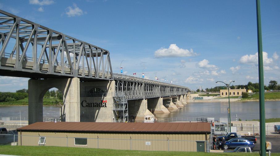
About 50 miles into the ride, we took a 10 mile (round trip) sightseeing side trip to see “Canada’s longest Suspension Bridge and “zip” line. After 3 miles on a paved road and 2 miles on a gravel road, we got to the site. Let’s say we were taken for a ride… To walk the 20 minute circuit going over the suspension bridge would have cost us $20.00, and an additional $60.00 if we wanted a ride on the ½ mile long zip line. We felt that on our detour to the site we saw at least $20.00 worth of scenery so we passed on the added expenses.

One of the neat things about riding across the country is coming across other folks who are doing it – today we passed 4 people from Quebec who started in Montreal, rode to Newfoundland, flew to Vancouver and are now on their way back to Montreal – let’s hear it for having a truck to schlep all your gear!!!

The last 30 miles of today’s ride were into a headwind, and once we got about 6 or 7 miles from the end, they were in the process of resurfacing the road. This can be quite a pleasant experience for cyclists – riding on freshly paved surfaces, but we were about a week or so too early. The road top had been ground off leaving a bumpy surface on which to lay fresh asphalt, and the ride was quite harsh on the seat/hands/feet!

The only saving grace was that every kilometer or so there was a “Terry Fox Highway of Courage” sign which reminded us that things were not so bad. Had Terry been here he would have just sucked it in, gritted his teeth and kept on running, so we rode on keeping our whining to ourselves.

It looks like the surface continues for tomorrow’s ride.

We are in a private campground, and that means we have internet (WiFi) access – I guess that is their means of differentiating themselves from the Provincial Campgrounds – that, and a lack of voracious mosquitoes.
Another hard day tomorrow – today, with the sightseeing detours we covered over 80 miles.

So far I have logged 2,568 miles since arriving in Vancouver, and we have yet to reach the 1/2 way point in the ride.

Wednesday, July 28, 2010

Day 32 – Luxury (Thunder Bay – Rest Day)

Rest day was the usual Blah! Blah! Blah! (or yadda yadda yadda for the Seinfeld fans out there!) - big breakfast (x2) laundry, replace rear tire on bike, get stuff from bike store, clean & lube chain on bike, replace replaced rear tire on bike (my patch of the sidewall cut on the replaced tire didn’t hold) and ended with a trip to the $6 buffet at the Lakehead University cafeteria. A bunch of us went and each ate about 5 full plates of dinner.

The key highlight of this rest stop was that after 32 days of camping in all sorts of conditions, we got to sleep indoors in real beds last night and tonight – well, I got a cot but it was very comfortable. I thought I could make it through a day without taking a picture, but the cot was too tempting.

No fighting off mosquitoes in the shower or at dinner, no running out of hot water in the shower, no loonies for the shower, no waiting in line in the truck for someone to unplug their cellphone, laptop, iTouch, GPS, camera charger so you could recharge your device(s) (did I mention that we were roughing it!), no rolling up a wet tent fly and groundcloth in the tent bag, etc., etc., etc... I’ll have to stop there or I might get awarded the “princess” tiara for complaining. It is not really a complaint, just a list of some of the things we have to deal with/adapt to as campers. It really is a lot of fun!

Tomorrow we start our long hilly ride up and down, and up and down, the Canadian Shield along the north shore of Lake Superior. Pretty remote areas so updating the blog may have to wait until we get nearer Sault Ste. Marie.

Day 31 – On to the Great Lakes! (Quetico ON – Thunder Bay ON)

Today’s ride was another long one (107 miles with yesterday’s being about 103 miles) in hot, humid weather – we actually saw temperatures in the mid-90°s.

The route, like yesterday’s had very few services along the way so we had to plan carefully once again. Since we were the galley crew last night, and for this morning’s breakfast, we were also responsible for sweep. With this in mind, Marc and I opted for an unstressed start and were on the road at 8:15 – the primary motivator was to close off the “all you can eat” buffet for the mosquitoes.

The ride was a little more complicated than yesterday’s, and a little hillier and hotter in my opinion. We did have some nice attractions along the way, including entering into the Atlantic watershed, and the Eastern Time Zone.


We also got one of the mysteries of the last few days answered:

“What is a Pulp Load Check station?”

In this part of the country there are lots of trucks carrying logs of varying lengths – apparently there have been problems with load shifts resulting in a stray log or two hanging off the side of the trucks (quite the danger to cars and cyclists). To address this, pulp trucks must drive through these “stations” in which the two drums on either side of the trailer push everything back into place. While we were checking out the station above, some truckers refilled our water bottles with very cold, greatly appreciated water – another example of the great hospitality we have experienced along the road.

Towards the end of the ride we visited Kakabeka Falls for one of our breaks - pretty impressive, but even more so when they had massive flooding just 6 weeks ago.

With the time change, riding sweep, and all, we pulled into Thunder Bay at the western end of Lake Superior a little before 6 PM – a long day (just shy of 10 hours) on the road.

Rest day tomorrow will be greatly appreciated – the first time we sleep in real beds since Vancouver on June 26th!!!

Tomorrow, I am off to find a scale to see how much weight I have lost so far!


Day 30 – Hills (Taylor Cove ON – Quetico ON)

Today’s ride was another 100+ miles in the Canadian Shield.

We started off the day seeing a bald eagle soaring beside us over one of the many lakes along the route. Those birds are huge! Unfortunately it dipped down near the water so it does not appear in the photo.

It was another day of hill riding (seemingly three up and one down). Today’s route instructions were the simplest to date. Ride 1 mile out top the main highway, turn left, ride 93 miles, turn right. There were very little services along the route, so we had to manage our fuel and fluid consumption very carefully.


Along the way we came across a number of First Nations villages with some very interesting names...  Try saying this 10 times quickly (or even once quickly!!!)

About 70 miles into the ride I took a 6 mile (round trip) detour into the town of Atikokan to get ice cream and top up the water bottles. Apparently the town was founded as a mining town, and when we got there, the whole “downtown” was torn up as they were redoing the main street. They did have some neat (and very large) mining equipment on display. I popped my bicycle into the shovel of a “steam shovel” just for fun. You can see the teeth of the shovel at the bottom of the picture to get a perspective on how big it is.
Our campsite for the evening was another provincial breeding ground for mosquitoes. I now have mosquito bites on my mosquito bites!  There were some pretty interesting mushrooms in the woods.  


Our crew was the galley crew for the evening so I had planned a special dessert “Bananas Faster” – a Bananas Foster inspired recipe. It was such a hit it was suggested that I write down the recipe for future Tours… Here it is!

BANANAS FASTER

Ingredients:

8 Gallons of Vanilla Ice Cream,
42 bananas sliced in half lengthwise, and then quartered,
3 cups margarine,
6 cups dark brown sugar,
2 teaspoons cinnamon,
2 teaspoons vanilla,
2 cups rum (optional, I supplied this myself)

Directions:
Heat two 20” aluminum frying pans over medium heat and melt 1½ cups of margarine in each. Add 3 cups of dark brown sugar to pan and mix with melted margarine. (Be careful not to caramelize the mixture or your cooking crew will not enjoy having to clean out the pans!) Stir in 1 teaspoon of cinnamon, and 1 teaspoon of vanilla into each pan. Add the bananas (1/2 to each pan) and cook briefly the bananas are well coated with the sugar/margarine and slightly softened. Remove the pans from the heat and place near the ice cream on the serving table.
Optional flambĂ©: Fill a large ladle with ¾ to 1 cup of rum, and heat over the gas burner. Ignite the rum and flambĂ© it onto the bananas/sugar/margarine mixture (be careful not to burn yourself or others during this process as the flame from the rum may not be visible).

Serve 1 scoop of ice cream in each bowl, and cover with the “Bananas Faster”.

Serves 42 hungry cyclists.

Note: Best planned for the evening before a rest day, or two evenings before, as it uses up alot of bananas which may go too ripe over the rest day.

It was a big hit, and despite bananas being a staple for energy during the ride, the entire batch was gobbled up - amazing what you can do with brown sugar, margarine, cinnamon and rum!

Tuesday, July 27, 2010

Day 29 – Canadian Hospitality (Caliper Lake ON – Taylor Cove ON)

After feeding the mosquitoes before leaving camp, we headed out on the road around 8:15 AM. Today’s ride was much like yesterday’s a series of rolling hills (flatter than yesterday, and nicer pavement. We headed south and then once we got just north of the Canadian US Border, headed east.

At Fort Frances, I took a side trip into the US to International Falls MN – apparently the coldest place in the US in the winter. It was well worth the visit as I got a chance to have a really good iced coffee (it was in the mid 80°s today) at a nice coffee roasters (Coffee Landing on Main Street for future TdC riders). At the store, a number of folks, seeing me in my “TdC” jersey asked me about the ride, and were quite excited about the whole adventure.

After returning to Canada (my first time crossing into Canada on a bicycle) I headed east from Fort Frances.

About 15 miles into the ride, along a causeway through Rainy Lake, I saw a float plane loading at an outpost and road in and onto the dock to see if they were going sightseeing. To my dismay they weren’t – the pilot was flying somewhere to repair something. I started talking with the two people left on the dock, and explained to them what I was doing in the area, and got asked “Are you in a hurry?”

Given I am in “touring” mode, and my view of getting to the campsite early was so that I could try and kill off all the mosquitoes before other riders arrived, I responded “No, I have got plenty of time.” To which the response was “If you have the time, I can show you something really interesting out on the lake.”

My host, Dick Armstrong (or was it Anderson?) ended up giving me a great tour out on Rainy Lake. It is Canada’s 45th largest lake stretching 55 miles East/West and 25 miles North/South in an “L” shape. The boat ride took me under the trestle bridges for both the causeway and the railway, and I still can’t figure out how we made it through, at speed, without hitting anything. It involved a tight “S” turn with about 3” clearance in each side of the boat. I have the whole thing on video so it should make for great watching.

Dick took me out in the lake to see an Indian (First Nations?) pictograph on a cliff. Apparently it is one of two pictographs on Rainy Lake.

In the lower right there is an overturned canoe, above that a Thunderbird and above that an upturned body. To the left is a depiction of a bolt of lightning. Apparently legend has it that it depicts the drowning of someone (important enough to have a pictograph made) during a heavy rainstorm on the lake. Apparently the tradition, when creating these pictographs, was to scrape the rock face clean before drawing. This provides a means by which they can be “dated” through determining the amount of lichen overgrowth at the edges. It was really neat to see something off the beaten track that I would not have seen otherwise.

Dick also took me to see the cabin he is building on one of the islands – it has a “million dollar view” of both Rainy Lake, and the Minnesota coastline on the far shore. One of the highlights of the trip so far! Let’s hear it for great Canadian hospitality.

Camp was great as well: flat ground, easy to put the tent pegs in; sunny to dry everything out; no mosquitoes, other than those that came along in the truck; and a warm lake in which to swim.  I think if we had a choice, we would choose to have a rest day here.

Today marked the last day of the Tour de France, so I thought I'd show how much ground I have covered (highlighted in yellow of course!) while the race was on in France. 


Day 28 – Hill Repeats (Kenora ON – Caliper Lake ON)

Our ride today basically consisted of a fairly fast ride through a series of rolling hills. It was great to be out of the Prairies, and riding through the Canadian shield. It seemed that on each granite rock, someone had built an Inuksuk, a stone statue which appears to be a “green” form of graffiti. I took a few moments on the side of the road and left my mark - complete with a moss hairpiece!

When we stopped for lunch on the side of the road, we happened upon a patch of fresh ripe blueberries, a rather nice break from ripe bananas.

Once again the roadside scenery was spectacular, with a new lake of bay every few miles...

We arrived in camp, basically a provincial park where mosquitoes happened to be a protected species. Before we could get our tents pitched, we had about 40 mosquitoes drawing blood from our exposed surfaces, and it did not let up until we went to bed.

Other than the bugs, and the fact that there was not a level piece of ground on the campsite it was great – hot showers (free), and a great lake for swimming.

Day 27 – Lake of the Woods (Rest Day – Kenora ON)

After a fitful night’s sleep (It finally stopped pouring rain at around 4 A.M.), the skies cleared in the morning and we headed into town to do laundry, and eat!

Kenora is on the northern end of Lake of the Woods, so we decided to take a boat tour in the afternoon. The lake is spectacular, lots of little islands, and inlets with a total shore line of 65,000 miles. Apparently it was an ideal smugglers paradise during prohibition. There are lots of bald eagles nesting on the lake and we saw a couple. The lake also has lots of “camps” (basically large island cottages with power fed by underwater power lines).


During our boat tour I got a chance to see where my mother had her first job counseling at a camp on one of the islands. Here is a shot of the Devil’s Gap in the lake.

Here is a shot of the "Devil" which gives the Devil's Gap its name.

From the looks of things things have not changed too much since then, except a lot of the property on the lake has transferred back into First Nations hands.

All in all it was a well earned rest day and just the thing we needed before heading off towards Thunder Bay.

Friday, July 23, 2010

Day 26 - Relief at Last!!! (Beausejour MB - Kenora ON)

After a great night sleep, we started out at a little before 8 AM for our longest leg of the tour (106 miles).

Our route today took us due east through more prairies, and then south east through a provincial park in eastern Manitoba. 

Before we got to the park, we had one last bit of prairies to cross - here is my final (I hope!) East/West perspective - notice how the wheat fields on either side of the road have been replaced with woods!
About an hour into the ride we rode through the little town of Gladstone MB, and stopped at a tea house for freshly baked cinnamon buns.  Well worth the stop.  The lady running the tea house had checked her calendar from last year and figured out when the "Tour" riders would be coming through so she had plenty of freshly baked "sticky buns" ready for us - not so simple a task given the number of bikes on the lawn.


Halfway along the route, we finally saw the last of the prairies, and on entering the Provincial Park started our ride through the Canadian shield.  Finally a real change of scenery :)  Who ever thought rocks could be so exciting!!!


In the park I wanted to stop at the Goose Sanctuary, where they advertised 181 protected geese.  Somewhat of a disappointment when I found that the geese which were protected were Canada Geese, which are basicaly urban pests in New Jersey - we have probably 200 of these geese on each of the soccer fields at home in Randolph.  Needless to say I did not stay long.

Today marked our entry into the 5th province of the tour - Ontario.  We were greeted with 10' wide freshly paved shoulders which made for great riding (at heast for the first 20 miles).


After what seemed like a few weeks of riding in great, sunny weather, our luck finally came to an end.  About 10 miles from Kenora, the skies opened up on us and we got soaked!  We stopped to warm up, and attempt to dry off and wait for the storm to pass before pitching our tents.  No such luck, I ended up pitching my tent in driving rain, and having to mop it out before putting our stuff in - it worked out quite well and despite the torrential rain (until 4 AM) I got dry and warm.  Apparently it rained over 3" in less than 8 hours.

Rest Day tomorrow!!!

Day 25 - Hitchikers (Minnedosa MB - Beausejour MB)

Today was one of the harder days of riding - not that the terrain was particularly difficult (as flat as glass), but mentally, another day in the prairies was quite the challenge - endlessly straight roads with no turns!!!

It  reminded me of some movies that I have seen where the director does not seem to know how to end it, and you are sitting there for the last 45 minutes of a two hour movie wondering when, if ever, it will end.

Our route took us north of Winnipeg (the provincial capital), and with 30 miles to go in our 100 mile ride, we stopped to visit Fort Garry, the major supply depot for the Northwest Territories (before they became provinces).  We ended up riding in a four person pace line to save energy, and keep things moving along. 

Our first stop was for our second breakfast of the day (usually after churning out about 30 miles).  As usual we took over a restaurant on the side of the road with swarms of riders coming in every 30 minutes or so and filling up the place.  We were 14 in a place that seated 16!

One of the more interesting aspects of this is that we managed to pick up "hitchikers" while riding.  Occasionally, a swarm of blackflies (each about an inch long) would join us and buzz about in the relatively calm air between the riders.  At first it was somewhat unnerving as these bugs pack a pretty good wallop when they bite, but we soon realized that for some unknown reason, they were not able to land on us while we were moving along.  They would buzz about going back and forth between the riders, and side to side, which was somewhat distracting.  I couldn't help but wonder how they felt after breaking away and finding themselves about 20 miles further down the road than when they joined us.

One thing I have noticed along the route is some of the more amusing signs that you see when either stopped to refuel (as in this case) or riding along. If any of you have a Rembrant, Picasso, or Rodin that need sandblasting, I know just the place!

After Fort Garry, we crossed the Red River - one that always seems to flood, both in the US and in Canada, in the spring and had a 25 mile ride into camp.  Being pretty fatigued of the ride so far for the day, all I wanted to do was to get it over with, so I laid down a pretty good pace and rode the last leg at about 22 MPH.  When I got into camp, I was quite relieved to have finished the day, and hopefully our last full day of prairie riding.

Day 24 – Churning out the Miles (Minnedosa MB to Portage la Prairie MB)

The temperature today was in the mid 80°s and not a cloud in the sky. Since I was on breakfast crew, we got off to a late start (8:45 A.M.) after feeding everyone a hot pancake breakfast, packing up our tents, and loading the truck with everyone’s luggage.


I decided to ride alone and basically got into a rhythm pedaling at a pace which kept my heart rate between 60% and 75% of maximum. My speed was between 18 and 22 MPH which allowed me to churn out the mileage. I wasn’t too interested in sightseeing (more prairies) yet I still managed to stop and take 32 photos.

For future riders of the Tour, the bakery in Gladstone MB (about ¼ mile off the main highway Rte 16) is well worth the detour – great pastries, and great ice cream!!!

It turns out that the unplanned theme of the day was “Really Big Things” starting with my record sized pancake finishing off the remaining batter – the hardest part was getting the “flip” without having the pancake fall apart.  
It seems that the telltale sign for a town of any size in the prairies is a large farm equipment dealership at the east and west ends of the towns. They usually have huge farming equipment lined up alongside the road looking like huge insects. Here is a shot of one of the machines – to give you a perspective of its size, my bike is leaning against it (front center).

One of the canola fields on the north side of the highway went from the road to the horizon, which in the prairies is a pretty long way (easily over 3 miles). The biggest single field we have seen so far.

Occasionally as we are riding along the road we will see oversized trucks carrying type of machinery or another – thankfully all of them have been heading in the opposite direction, so we are not forced off the road. Here is a collection of what we saw today and yesterday:


I could probably ride my bike under the middle of this without hitting anything!!!

Towards the end of the ride, we passed by a huge grain elevator – basically a collection facility replacing all of the individual grain elevators which used to mark each prairie town. Again, to get a perspective on the size of the facility, if you look at the bottom of the photo, you can see a diesel locomotive (the small blue “box”) in the foreground.


After 85 miles of riding alone, at 20+ mph in the heat, I decided to quench my thirst at the local A&W in Portage la Prairie – again following the “BIG” theme.

Great riding, great weather, but we are getting anxious to see something other than fields of grain.

Monday, July 19, 2010

Day 23 – This Little Piggy Went to Market (Binscarth MB – Minnedosa MB)

Apparently the swarms of mosquitoes that Saskatchewan is famous for, and which we missed, heard that we were headed for Manitoba and decided to meet us there. After finishing my blog last night, my arms and legs looked like I was on the losing team in a dart fight. They are not much better tonight.


Today started out under overcast skies and temperatures in the mid-50°s. It was another day being surrounded by oceans of yellow canola fields.

 The ride was fairly short (84 miles) so we decided to start later and take it easy.


 About 16 miles into the ride, we passed by what looked like a farm with some very large buildings, so I convinced Serge that we should ride up the gravel driveway, let the folks know about our trip and ask if we could get a tour of their facility. The operation was a breeding facility for piglets, with 2,600 sows delivering over 50,000 piglets per year. The manager of the facility emigrated from Scotland 9 years ago and was very friendly and proud of his operation.

He gave us a tour of each of the major sections explaining everything as we went through. Thankfully they gave us overalls and large rubber boots to wear for the “tour” - it took us about 10 minutes to get full control of our gag reflexes. The whole facility was geared for one thing only – to produce as many healthy piglets as possible, per sow, per year. It was quite the shock to see how this was achieved, although an education as well – basically a well-run efficient factory for creating piglets. Needless to say we were not allowed to take any pictures of the inside of the facility. Although the animals were treated with care, they are basically caged 24/7/365 and are in various stages of pregnancy for their entire “career” – some 5-7 years. Every week a semi with 1,000 to 1,200 piglets heads to the northern US states (North Dakota, Montana, etc.) from the plant.


The operation is staffed by 12 workers, all immigrants – a Scotsman, a Welshman, a couple of Germans and the rest Russians. They were all very nice and very interested in our excursion.

We then went on our way heading east to Minnedosa. The roads today were fairly good with a nice shoulder to ride on, although I did hit a large pothole which caused a puncture in my rear tire. Luckily the sealant stopped the leak so it did not inconvenience us too much. We arrived in camp shortly after three after yet another great day of riding.

Sunday, July 18, 2010

Day 22 – Rivers of Flax (Grayson SK to Binscarth MB)

Today was a rare day where we got to see our shadows in front of our bikes for the start of the morning ride. We opted for the “Scenic Route” which meant riding west into a head wind for 8 miles and then dipping south and down into the Qu’Appelle River Valley for a 30 mile ride along the river. The detour added about 40 miles to the day, a fair bit of climbing, and about 20 miles of riding into very strong head winds, but was well worth it, as shown in the 180° panorama shot below of the river valley.


The river is nestled about 400 feet below the plains in a valley lined with Canola fields and Flax fields. The Flax flowers are blue, and when viewed from afar, you can’t tell whether you are looking at a field or a lake/river.

That is flax on the right in the foreground, and a lake in the background.

After climbing back out of the valley and a 12 mile ride directly into a headwind, we stopped for lunch and a bit of rest - those lawn chairs were pretty comfortable and we all had a little 20 minute sunbathing session (aka nap!).

We then headed east (once again) with the head wind now at our backs.


We passed through an area of Canada with the largest potash resources in the world (enough to meet the global demands for 500 years at current consumption rates). Apparently a few hundred million years ago the area was a seabed where the sea salt settled providing potash today. In the picture to the left you can see a large mountain of potash mined from a seam about three quarters of a mile underground.


One thing we have noticed over the past few days is a large number of snakes on the road, some alive, but mostly road-kill.   At this point I was riding with Kelly and his wife Judy, who had been wanting all day to get a picutre of a live snake sunning itself on the road (not too smart thise snakes!)  Here is an amazing shot we just chanced upon.


Well not really, we stopped by a quite large, intact dead snake which Kelly removed from its spot of demise, and repositioned in his best attempt to replicate a slither. Here is a shot of him getting a "Marlin Perkins" photo of the garter snakes of Saskatchewan - notice that the snake is in exactly the same position (dead!) as my earlier photo.


After crossing the border into our 4th province (Manitoba) we had another drop into the Assiniboine River Valley and then up the other side into the town of Binscarth where we are camped beside the highway and railroad tracks. Despite the potential for noise, we should sleep well as we have ridden for 100+ miles over each of the past two days.

Got to go now as the mosquitos which never showed up in Saskatchewan are eating me alive!